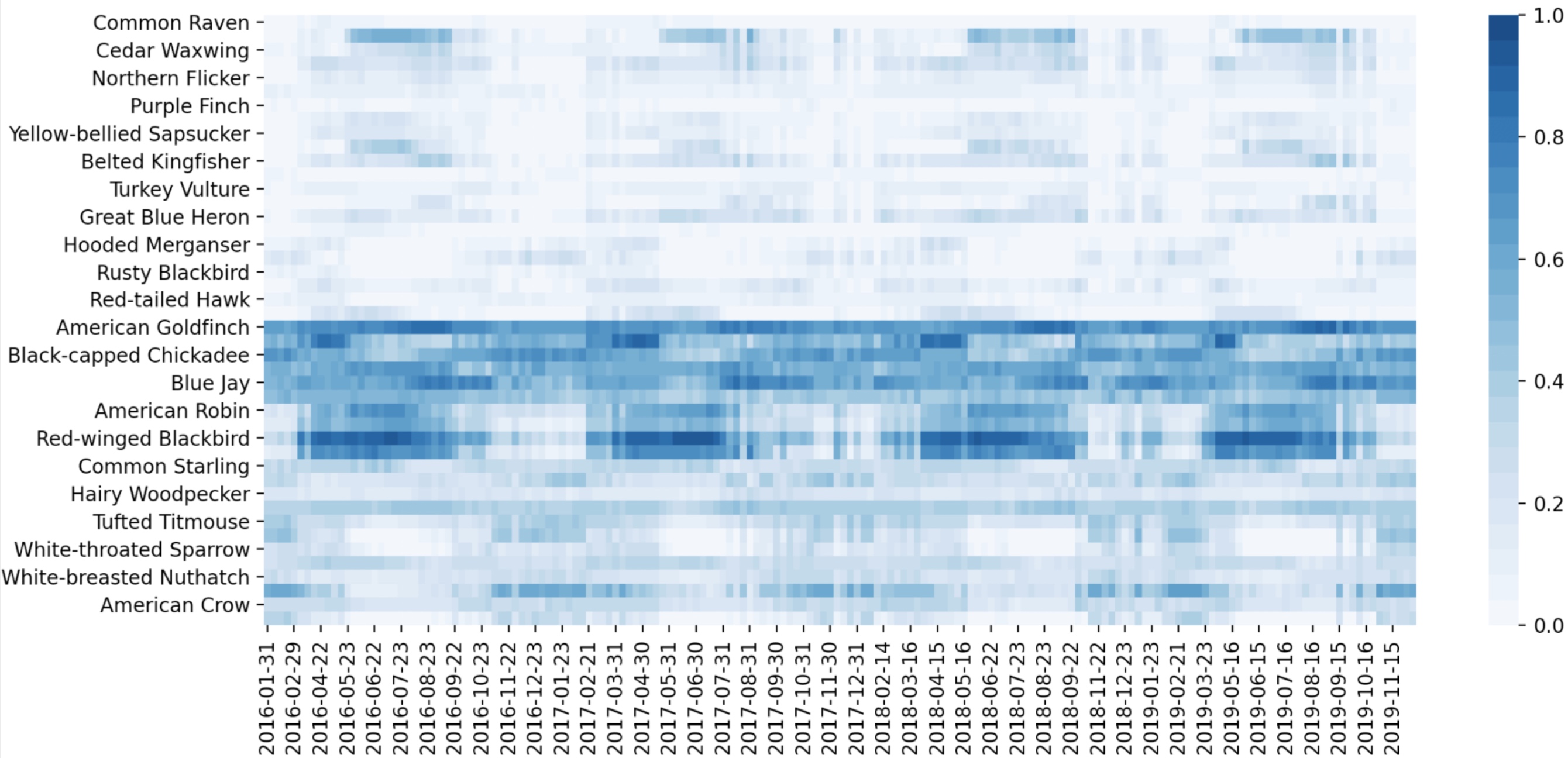
Research Statement: With the growing scale and complexity of wicked environmental problems, deep learning techniques have been increasingly used to leverage vast remote sensing data sets for land use classification, flood extent mapping, tree species classification, and soundscape characterization. State-of-the-art architectures like 3D convolutional neural networks and DenseNets can be applied to hyperspectral imagery, which contains hundreds of bands, for accurate classification tasks. By combining these with Recurrent Neural Networks, specializing in time series analysis, it is possible to explore predictive land use or biodiversity changes based on historical imagery and climate data. These networks can also be applied to environmental soundscapes, in the form of spectrogram images, for quantifying biodiversity and the effects of noise pollution. The goal of this research is to apply state-of-the-art deep neural network architectures, automated machine learning techniques, and data explainability methods to develop powerful and transparent ecological monitoring and prediction tools.

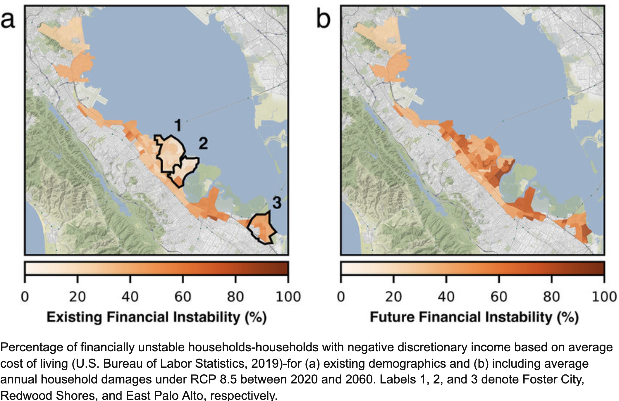
Abstract: Increasing coastal flooding threatens urban centers worldwide. Projections of physical damages to structures and their contents can characterize the monetary scale of risk, but they lack relevant socioeconomic context. The impact of coastal flooding on communities hinges not only on the cost, but on the ability of households to pay for the damages. Here, we repurpose probabilistic risk assessment to analyze the monetary and social risk associated with coastal flooding in the San Francisco Bay Area for 2020–2060. We show that future coastal flooding could financially ruin a substantial number of households by burdening them with flood damage costs that exceed discretionary household income. We quantify these impacts at the census block group scale by computing the percentage of households without discretionary income, before and after coastal flooding costs. We find that for several coastal communities in San Mateo County more than 50% of households will be facing financial instability, highlighting the need for immediate policy interventions that target existing, socially produced risk rather than waiting for potentially elusive certainty in sea level rise projections. We emphasize that the percentage of financially unstable households is particularly high in racially diverse and historically disadvantaged communities, highlighting the connection between financial instability and inequity. While our estimates are specific to the San Francisco Bay Area, our granular, household‐level perspective is transferable to other urban centers and can help identify the specific challenges that different communities face and inform appropriate adaptation interventions.

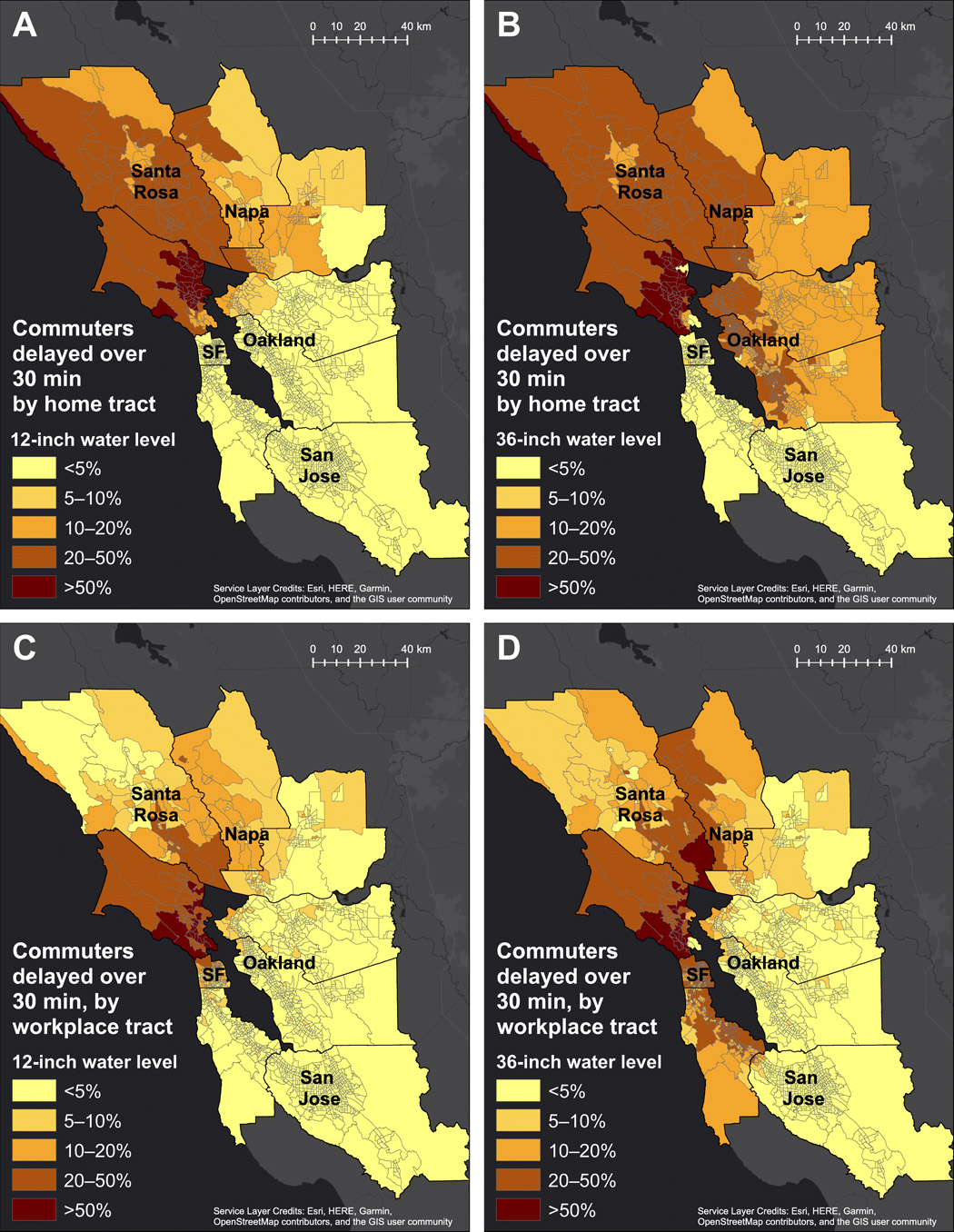
Abstract: As sea level rises, urban traffic networks in low-lying coastal areas face increasing risks of flood disruptions. Closure of flooded roads causes employee absences and delays, creating cascading impacts to communities. We integrate a traffic model with flood maps that represent potential combinations of storm surges, tides, seasonal cycles, interannual anomalies driven by large-scale climate variability such as the El Niño Southern Oscillation, and sea level rise. When identifying inundated roads, we propose corrections for potential biases arising from model integration. Our results for the San Francisco Bay Area show that employee absences are limited to the homes and workplaces within the areas of inundation, while delays propagate far inland. Communities with limited availability of alternate roads experience long delays irrespective of their proximity to the areas of inundation. We show that metric reach, a measure of road network density, is a better proxy for delays than flood exposure.

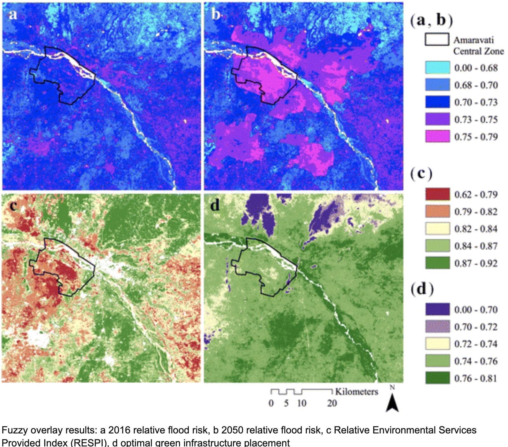
Abstract: The Indian State of Andhra Pradesh is in the process of designing and constructing a planned capital city on the southern banks of the Krishna River at Amaravati. This region will see a significant increase in urban land cover and impervious surface area (ISA) under the 2050 draft perspective plan from the Andhra Pradesh Capital Region Development Authority. As the city central zone sits on the former floodplain of the Krishna River and is subject to concentrated rainfall during monsoon seasons—this increase in ISA risks increasing flood risk through preventing infiltration of storm water and causing increased peak storm water flow (NRSC 2014). The State has announced plans for a “zero-flooding city” through implementation of technologies including green roofs, porous pavement, and detention ponds (ADC 2017). This study aims to facilitate these efforts through mapping of present and future land usage, regional flood risk, and environmental services utilizing open-source data in order to maximize efficiency of installed green infrastructure and minimize future flood damages. A map of relative soil infiltration capacity was created through fuzzy overlay of sand percentage, clay percentage, and bulk density at several depths. Relative flood risk maps for both present-day land cover and a 2050 scenario were developed using several factors: elevation, flow accumulation, surface runoff, and soil properties. A novel Relative Environmental Services Provided Index is proposed here to in order to encourage cost-effective and ecologically sound development through composite visualization of carbon storage, greenery, runoff coefficients, and soil flood prevention.